Renewables
Ibri Solar Project — 1,300 ha
High-precision RTK drone survey for solar array design and land-use optimisation on varied terrain, on a demanding timeline.

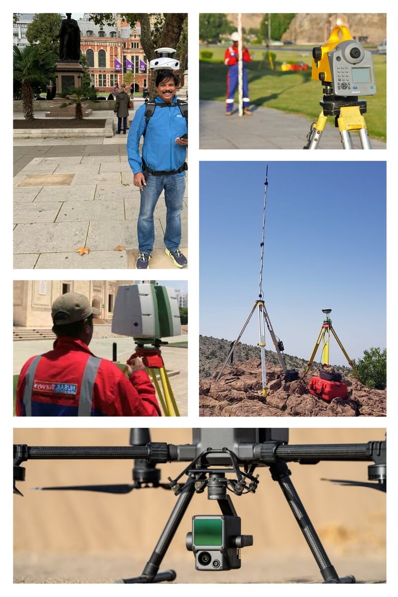
Over 120,000 hectares of terrain mapped with RTK drones, LiDAR, mobile mapping and 3D laser scanning — for Atkins, Wood PLC, OPWP, PDO partners and the Oman Investment Fund. One workflow: RTK benchmark transfer, controlled acquisition, Pix4D / Cyclone / Civil 3D processing, QA against ground control.
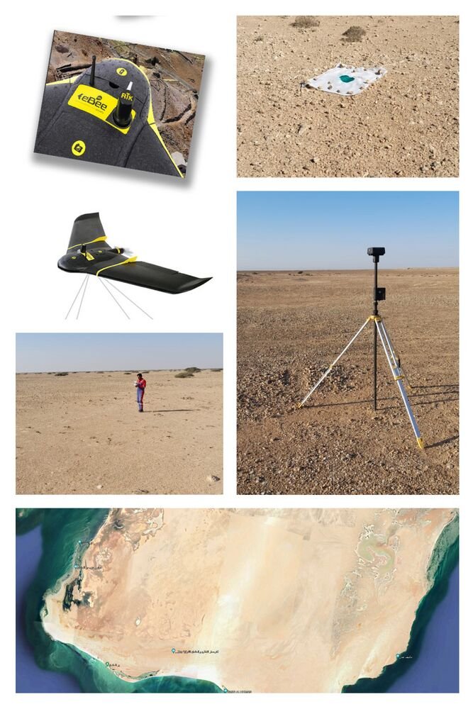 23.0700° N · 57.6600° E — JABAL AKHDAR
| Consultant | WS Atkins International & Co. LLC |
|---|---|
| Reference | NEC-JAA-AT-TPS-001-009 |
| Area | 17.80 km² — Jabal Akhdar, Oman |
| Processing | Pix4D Mapper — orthomosaics, 3D models, DEMs, point clouds |
17.80 km² of mountain terrain surveyed for a new mixed-use area, combining UAV LiDAR with RTK drone photogrammetry on Leica GS14 ground control. Acquisition ran 2–18 August with supplementary coverage 1–8 September; PDOP screening and multi-receiver GNSS checks verified accuracy against established ground control. Zero safety incidents.
| Client | Green Hydrogen & Chemicals PSG |
|---|---|
| Area | 10,200 ha — Duqm, Oman |
| Method | RTK UAV · mobile mapping · 3D laser scanning · Leica RTK GPS |
| Outcome | Full-coverage baseline delivered despite weather constraints |
Persistent high winds at Duqm interrupted conventional workflows, so acquisition combined RTK drone flights, vehicle-mounted mobile mapping and 3D laser scanning in wind-restricted zones — tied together by Leica RTK GNSS control and processed in Pix4D Mapper into orthomosaics, 3D models, DEMs and dense point clouds.
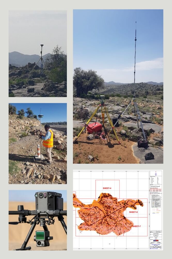 19.6500° N · 57.7000° E — DUQM
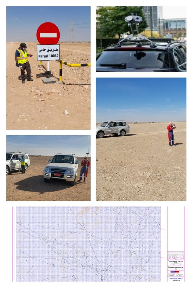 22.8000° N · 57.5900° E — MANAH
| Client | Oman Power & Water Procurement Co. (OPWP) |
|---|---|
| Area | 1,500 ha — Manah, Oman |
| Software | Pix4D Mapper · Autodesk Civil 3D · Leica Cyclone |
| Focus | Wadi delineation · drainage patterns · road design data |
A 1,500-hectare fast-track survey capturing wadi bed detail for flood-risk and drainage assessment, plus road networks and site features for array planning. RTK drone data was modelled in Pix4D, engineered in Autodesk Civil 3D, with Leica Cyclone processing high-resolution scan data.
| Client | Oman Investment Fund |
|---|---|
| Area | 80,000 ha — Barr Al Hikman |
| Method | RTK UAV · mobile mapping · 3D scanning · GNSS ground-truthing |
| Deliverables | Orthomosaics · DEMs · point clouds · contour & site mapping |
One of the region's largest single topographic commissions, surveyed under extreme summer temperatures and persistent wind. RTK drones, mobile mapping and 3D scanner systems held both pace and precision across the vast coastal site, with Leica RTK GPS ground-truthing throughout.
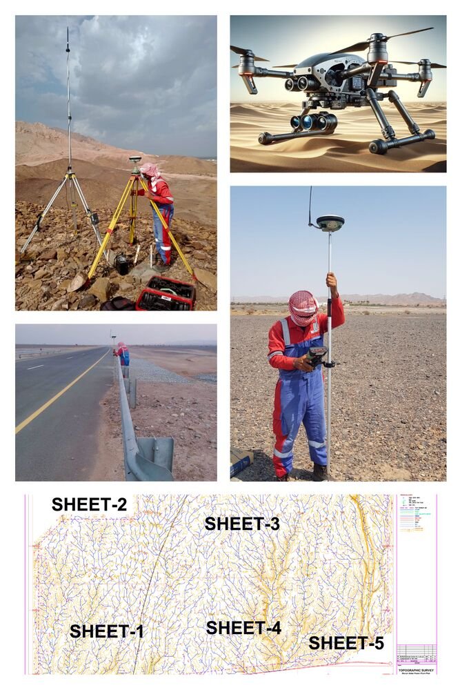 20.6000° N · 58.4000° E — BARR AL HIKMAN
 23.6300° N · 58.4900° E — RAS AL HAMRA
| Client | ONJP Oman (Ras Al Hamra PDO Project) |
|---|---|
| Area | 25,000 ha — Muscat |
| Verification | RMSE 0.98 · MAE 0.95 · ~300 ground control points |
| Confirmation | Independently checked by the client's surveyors |
ONJP Oman set a stringent accuracy requirement for this development survey. RTK drone flights were verified against ~300 strategically distributed Leica RTK GNSS ground points; independent checks by the client's surveyors confirmed an RMSE of 0.98 and MAE of 0.95 — precision beyond standard large-area practice.
| Consultant / Client | Wood PLC · Duqm Refinery |
|---|---|
| Scope | 236 km corridor + 2,000 ha plots |
| Deliverables | Geo-rectified mosaics · DTMs · benchmark network · analysis reports |
Corridor and plot survey for Wood PLC: mobilisation and permitting, RTK drone and mobile-mapping acquisition, permanent benchmark establishment and calibrated coverage beyond the plant boundary — plus DEM watershed analysis, vegetation and tree mapping, underground utilities and community mapping.
High-precision RTK drone survey for solar array design and land-use optimisation on varied terrain, on a demanding timeline.
Precision survey for solar receiver tube placement at a live oilfield; 3D scanning around existing infrastructure with minimal disruption.
Topographic analysis of land, water features, soils and environmental constraints to guide pond and infrastructure design.
1,000 ha site survey plus a 100 km road corridor with traffic coordination throughout.
3D scanner topographic survey for Oman's flagship urban development at Al Irfan, Muscat.
3D scanner topographic survey for the Al Bandar development on behalf of the MoD Pension Fund.
Tell us the area, accuracy and deliverables — we propose the right mix of UAV, LiDAR, scanning and ground survey.