
Saudi Arabia marine & water quality case studies
Multibeam bathymetry, seawater quality profiling and satellite-derived elevation modelling on both Saudi coasts — supporting the Kingdom's desalination programme from Al Khobar on the Arabian Gulf to Jazan on the Red Sea. Coast Guard permitting handled end-to-end, including reviews that run three months.
Permitted, mobilised and delivered on both coasts.
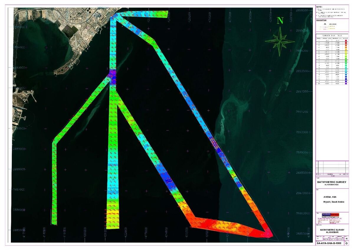 26.2800° N · 50.2100° E — AL KHOBAR
Seawater quality vertical profiles — Al Khobar
| Client | Ayesa (SWCC programme) |
|---|---|
| Scope | 13 vertical profiles · 10 seawater samples · single-beam bathymetry |
| Positioning | DGPS georeferencing along defined survey lines |
| Outcome | Water-quality baseline for desalination development |
Thirteen seabed-to-surface profiles captured pH, electrical conductivity, temperature, turbidity, dissolved oxygen and chlorophyll along prioritised bathymetric survey lines, with ten seawater samples collected 3 m above seabed for laboratory analysis in Dammam. Coast Guard approval was secured after a documented three-month review.
Bathymetric survey — Doga, for Environmental Horizons
| Client | Environmental Horizons (EH) |
|---|---|
| Equipment | M3 sonar · Hemisphere 113 positioning · RTK tide recorder |
| Software | Hypack & Hysweep · Agisoft Metashape |
| Deliverable | Seabed structure & DEM data for planning |
On-site hydrographic survey from an 8.45 m vessel combined with satellite-derived DEM processing: high-resolution imagery sourced via UP42 and processed in Agisoft Metashape through photo alignment, dense cloud build and DEM export. Full pre-deployment vessel safety audit.
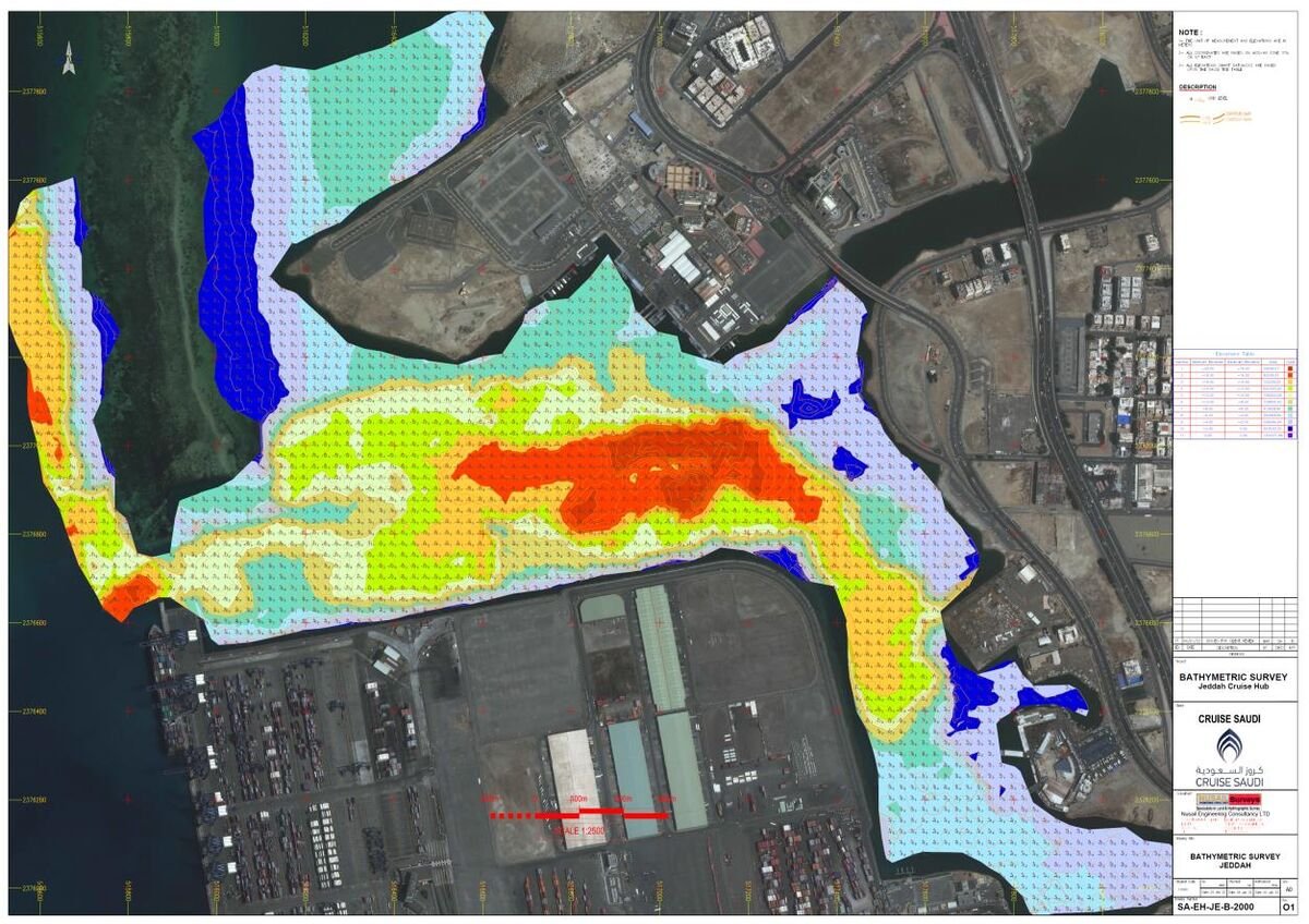 DOGA — RED SEA COAST, KSA
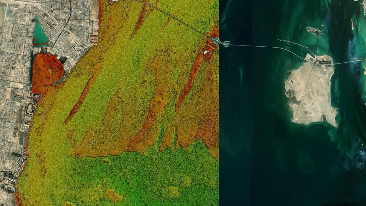 20.6600° N · 39.5100° E — SHOIBA
Bathymetric survey — Shoiba, for Ayesa
| Client | Ayesa (SWCC programme) |
|---|---|
| Challenge | Boat-inaccessible shallows · extended permitting |
| Method | Hydrographic survey + satellite DEM (ArcGIS Pro) |
| Outcome | Complete seabed model of the Shoiba site |
Parts of the Shoiba site were unreachable by boat, so the vessel campaign was integrated with satellite remote sensing: DEMs generated in ArcGIS Pro from raster elevation imagery — raster-to-point conversion and elevation extraction — filled the inaccessible zones, leaving no area uncharted.
The Red Sea & Arabian Gulf desalination programme.
Repeat commissions across the Kingdom's desalination plant sites, delivered for Ayesa under the SWCC programme, plus further marine work on both coasts.
| Client | Project | Location |
|---|---|---|
| Ayesa – SWCC | Multibeam bathymetric & seawater quality survey with buoy fixing | Al Khobar Desalination Plant |
| Ayesa – SWCC | Bathymetric & seawater quality survey with buoy fixing | Shoaiba 5 Desalination Plant |
| Ayesa – SWCC | Bathymetric & seawater quality survey with buoy fixing | Shuqaiq Desalination Plant |
| Ayesa – SWCC | Bathymetric & seawater quality survey with buoy fixing | Rabigh 4 Desalination Plant |
| Ayesa – SWCC | Multibeam bathymetric & seawater quality survey with buoy fixing | Umluj Desalination Plant |
| Ayesa – SWCC | Multibeam bathymetric & seawater quality survey with buoy fixing | Al Wajh Desalination Plant |
| Ayesa – SWCC | Multibeam bathymetric & seawater quality survey with buoy fixing | Duba Desalination Plant |
| Ayesa – SWCC | Multibeam bathymetric & seawater quality survey with buoy fixing | Al Haql Desalination Plant |
| Environmental Horizons | Multibeam bathymetric survey | Jazan, KSA |
| Environmental Horizons | Multibeam bathymetric survey | Doga, KSA |
| Red Sea Cruise Company | Bathymetric survey — Jeddah project | Jeddah Port, Red Sea |
Planning marine or coastal work in Saudi Arabia?
We handle Coast Guard permitting, vessel mobilisation and survey delivery on both coasts — offices in Jeddah, Riyadh and Dammam.