
Environmental
Al Ghubrah IWP, Muscat
4 km² bathymetry at 20 m spacing plus ROV benthic transects for the desalination intake/outfall — new octocoral, octopus and nudibranch records reported.

Sixteen port, harbour and intake/outfall surveys across Oman — multibeam and dual-frequency bathymetry, side-scan sonar, sub-bottom profiling, ADCP currents and benthic studies, reduced to Chart Datum and reported against IHO S-44 to the order specified for each survey. Delivered by our team through Nusail Engineering Consultancy for Ramboll, Atkins, DAMAC, Worley Parsons, OPWP and MISC & Veolia.
 16.9416° N · 54.0034° E — PORT OF SALALAH
| Client | Ramboll |
|---|---|
| Scope | Underwater quay wall multibeam survey |
| Equipment | M3 multibeam sonar · TSS DMS 3-05 motion sensor · AML SV probe & profiler · Valeport TideMaster |
| Software | Hypack & Hysweep |
| Positioning | Leica RTK + Hemisphere DGPS heading · local UTM |
Oman's largest port required an underwater quay wall condition survey. The M3 multibeam was pole-mounted with the GNSS antenna in the same vertical plane as the transducer for direct horizontal positioning; motion, sound-velocity and tide corrections were applied in real time, with daily CTD dips and bar checks.
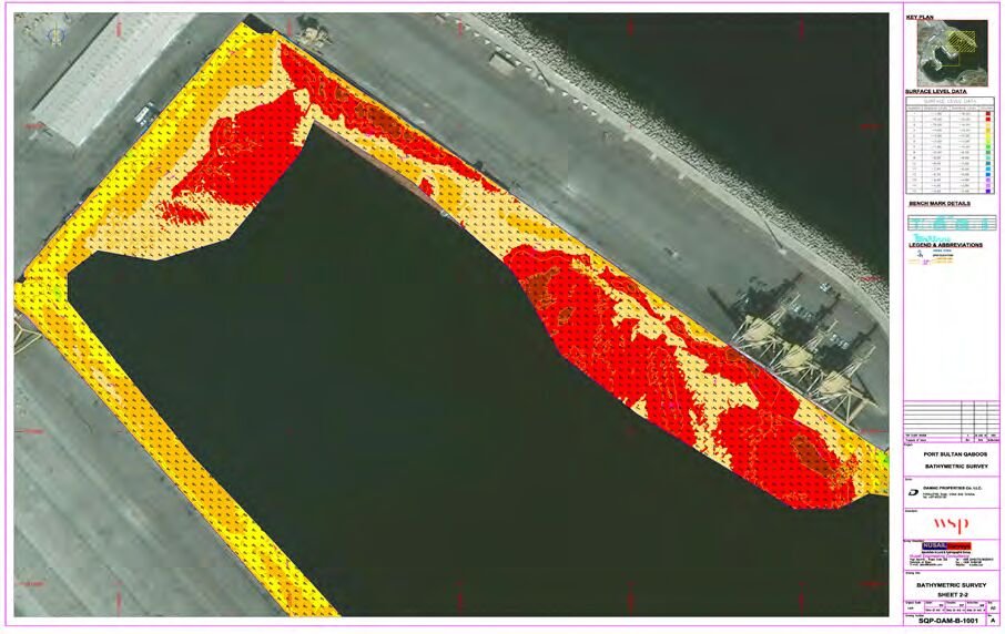
| Client | DAMAC — Port Sultan Qaboos Development Project |
|---|---|
| Scope | Hydrographic quay wall survey, berths 1–10 |
| Equipment | M3 multibeam · TSS DMS 3-05 · AML SV probe & profiler · Valeport TideMaster |
| Deliverable | Seabed layout, quay wall condition & foundation assessment |
A 114-hectare waterfront regeneration at Muttrah required quantitative assessment of seabed layout, quay wall condition and foundations at ten berths ahead of a 700,000–800,000 m² GFA development. Multibeam coverage was paired with dive inspection data.
 23.6250° N · 58.5667° E — PSQ, MUTTRAH
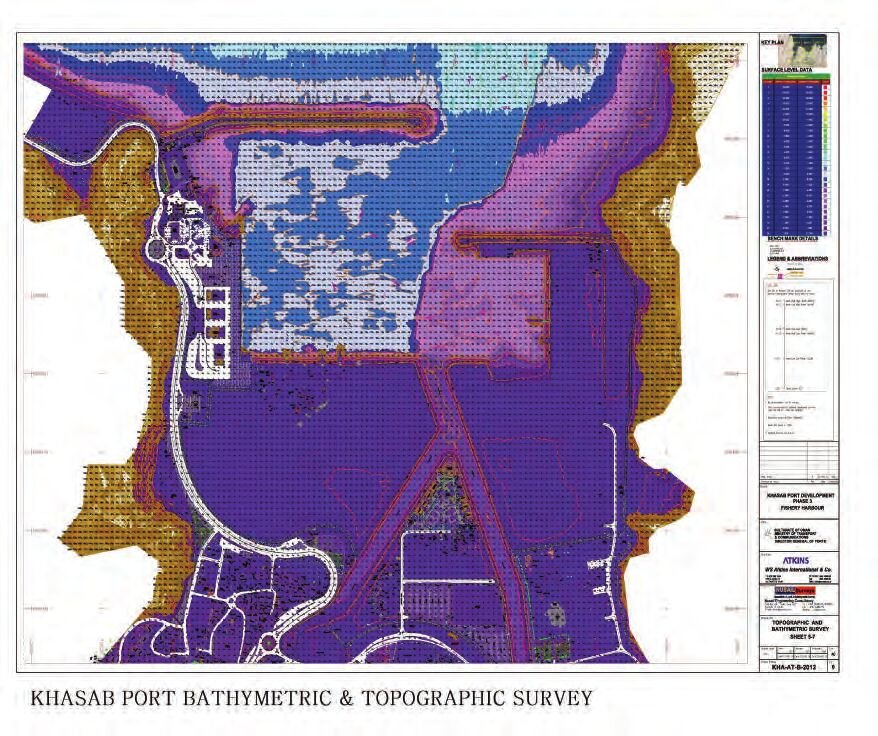 26.1908° N · 56.2477° E — KHASAB, MUSANDAM
| Client | Atkins |
|---|---|
| Scope | Bathymetric · side-scan · seismic · current measurement |
| Equipment | Odom Hydrotrac · EdgeTech 4125-P · GeoPulse pinger · RDI Teledyne ADCP · Sokkia RTK · Valeport tide gauge |
| Result | Sedimentary seabed characterised · 1:1000 chart · 30-day campaign |
Bathymetry, side-scan sonar, shallow seismic sub-bottom profiling and a four-station ADCP programme recording at 2-minute intervals through 2–13 m depths — covering the redevelopment area and the optional Khor Qada site. Sound velocity verified at 1520 m/s; 1:1000 chart delivered; wrecks and outfalls mapped as construction hazards.
| Standard | IHO S-44 Order 1a (as specified) · 1:2500 reporting · Admiralty Chart Datum |
|---|---|
| Metocean | 4 × ADCP full lunar cycle · 2 wave/current buoys, one month |
| Sampling | 50 water & sediment stations · 20 SSC samples · 15 probe profiles |
| Equipment | 2 × Odom Echotrac MKIII · EdgeTech 4125-P · GeoPulse · Midas CTD+ · Van Veen grab · Niskin sampler |
Shore-approach characterisation for seawater intake and outfall structures north of Duqm Port: 15 × 15 m grid bathymetry (±0.1 m depth, ±0.5 m position), three 160 m high-resolution corridors, geophysics, a full lunar cycle of ADCP at −12 m CD, two wave & current buoys, and 50 water/sediment stations sampled in summer and winter.
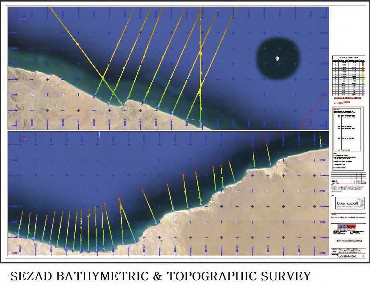 19.6600° N · 57.7000° E — DUQM SEZ
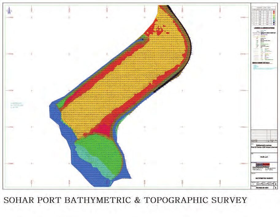 24.3700° N · 56.6300° E — SOHAR PORT
| Client | Majis Industrial Services (MISC) & Veolia |
|---|---|
| Accuracy | ±50 mm GPS-verified |
| Equipment | Odom Echotrac MKIII · Sokkia RTK · Hemisphere DGPS · Valeport tide gauge |
| Datum | UTM 40Q · WGS84 · Chart Datum |
Repeat bathymetric profiles monitored settlement at the MISC & Veolia RO plant seawater intake. Dual-frequency 210/33 kHz soundings positioned to ±50 mm with RTK GNSS, reduced to Chart Datum on UTM Zone 40Q, and charted at 1:1000 for comparison between epochs.
| Client | Worley Parsons |
|---|---|
| Sites | Mahout · Al-Shuwaimiya · Sadah · Rakhyute · Dibba · Kumzar |
| Method | Odom HT100 200 kHz · 20 m fixes · HydroPro · tide-reduced depths |
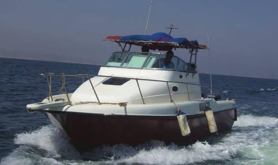
| Vessel | 32 ft survey vessel · pre-mobilisation safety audits · journey management |
Worley Parsons commissioned bathymetry, benchmark establishment and 1 m-contour topographic mapping at six fishery harbour sites spanning the whole Oman coast — Mahout, Al-Shuwaimiya, Sadah, Rakhyute, Dibba and Kumzar — so each harbour design was neither under- nor over-engineered. All six sites were completed within the client's time limit with zero safety incidents.
 OMAN COAST — SIX HARBOUR SITES
4 km² bathymetry at 20 m spacing plus ROV benthic transects for the desalination intake/outfall — new octocoral, octopus and nudibranch records reported.
Bathymetry for dredging quantities plus benthic transects T1–T4 in 3–40 m depths; soft sand and gravel substrata confirmed, no seagrass or coral.

10 m line spacing, 0.5 m contours at 1:1000; DWG and ASCII XYZ deliverables. Completed 02–09 January 2012.

210/33 kHz profiles at 20 m intervals; 1:2500 chart flagged an exposed rock sand bar at low tide in the dredging area.
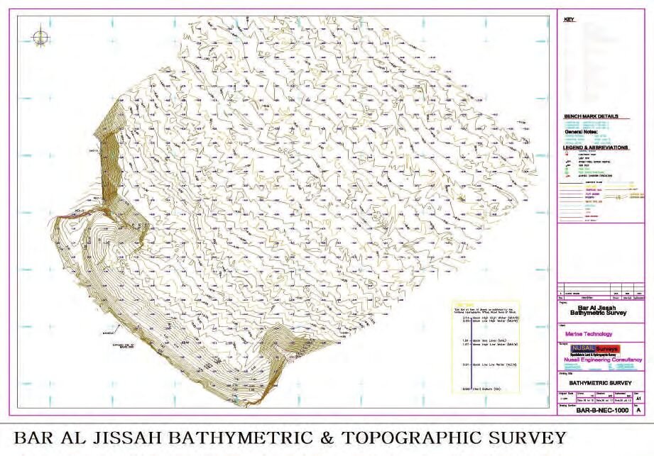
Seabed profiling along the dredging area on UTM 40Q / WGS84, vertical control on Chart Datum; 1:2500 chart.

Fishing harbour profiles reduced to LAT from a breakwater tide gauge; dredging quantities computed against design depth.

Pre-dredging profile charted at 1:750 with tidal reduction to LAT. Surveyed April 2012 for MOAF.
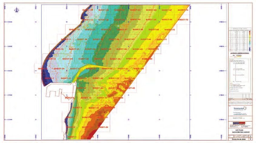
100 ha bathymetry on a 20 m grid plus 50 ha topographic survey; 0.25 m contours at 1:1500, DWG and XYZ deliverables.
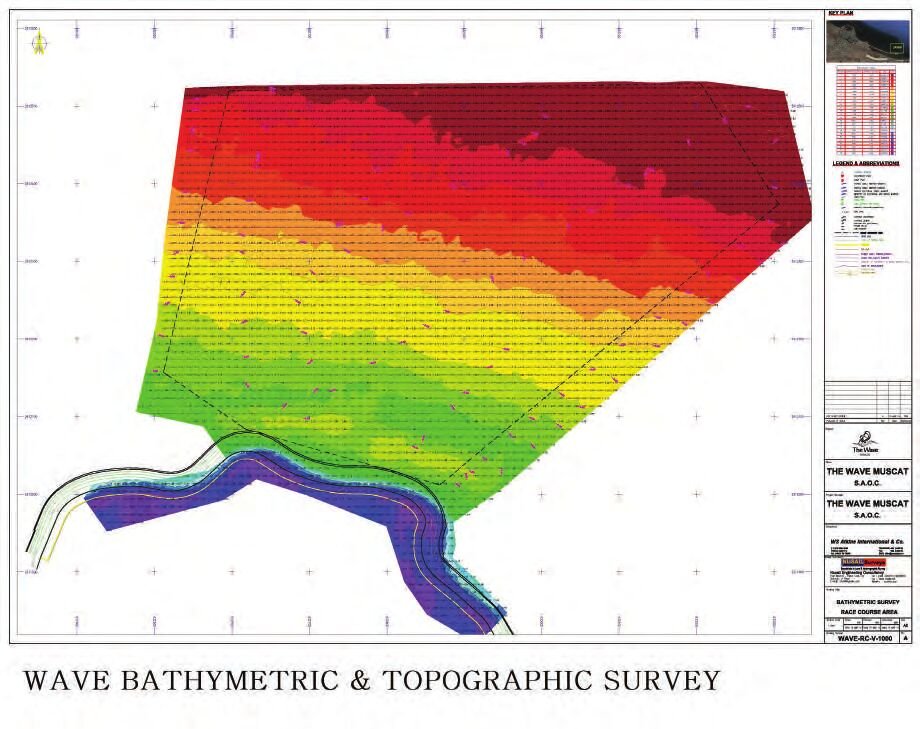
Offshore bathymetry for the waterfront development at 5 m minimum line spacing with 0.25 m contour mapping.
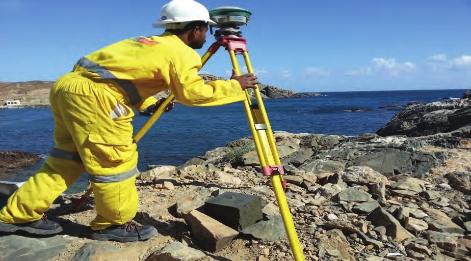
Every campaign ties to client or NSA benchmarks, with daily bar checks, CTD dips and journey-managed vessel operations.
Datum, accuracy and verification method are stated on each deliverable.
Send us your survey area and required standard — we respond with methodology, equipment spread and a fixed quotation.