
Land & Topographic Survey
Precise topographic and land surveys — control networks, detailed terrain models and boundary surveys that underpin design and construction.
Land & Topographic Survey
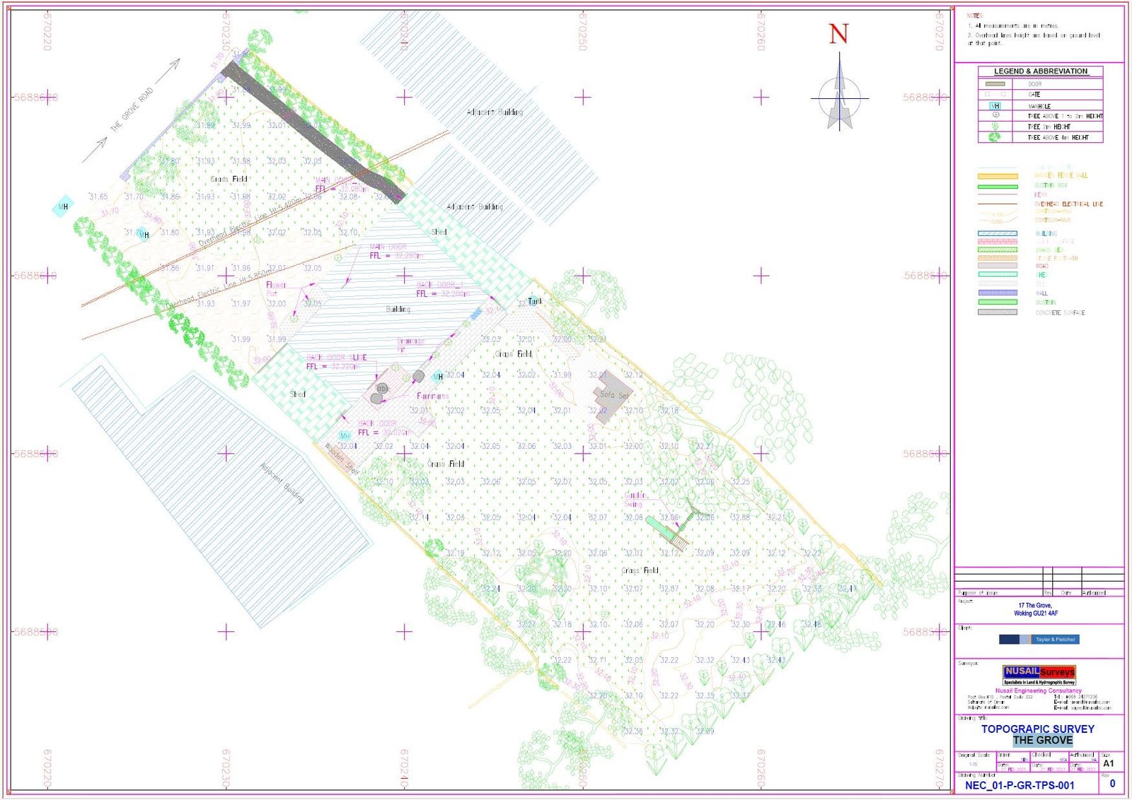
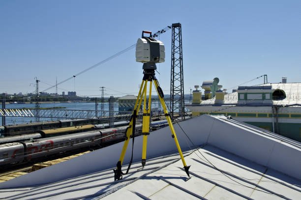
We capture the ground with survey-grade GNSS, total stations and, where it adds value, drone and scanning data. The result is a clean, fully attributed topographic dataset and DTM ready for design.
Every survey is tied to a robust control network with documented datums, so your model is consistent, repeatable and defensible across design stages.
Scope of work
- Detailed topographic surveys
- Control & boundary surveys
- Digital terrain models (DTM/DSM)
- Setting-out & as-built
- Volume & earthwork surveys
- Corridor & route surveys
Methodology
Establish & observe a control network (GNSS + levelling)
Capture detail with RTK GNSS and total station
Integrate drone/LiDAR where density demands
Model surface, draft CAD and QC against control
Equipment & technology
- Multi-constellation GNSS RTK
- Robotic total stations
- Digital levels
- DJI RTK UAV (where required)
Deliverables
- Topographic CAD (DWG/DGN)
- DTM/DSM surfaces
- Contours at required interval
- Control & coordinate schedules
Industries served
Related project experience

Questions, answered
What accuracy can you achieve?
Can you combine drone and ground survey?
Ready to turn field data into decisions?
Talk to our survey, software and GeoSystems specialists about your next project. Fast, professional, no-obligation quotations.