GISMappers SurveyCAD Pro
Software Product

GISMappers SurveyCAD Pro

All-in-one survey drafting and geospatial workflow platform for topographic survey, terrain modelling, point clouds, CAD drafting, GIS data management and professional survey deliverables.

Overview

GISMappers SurveyCAD Pro

All-in-one survey drafting and geospatial workflow platform for topographic survey, terrain modelling, point clouds, CAD drafting, GIS data management and professional survey deliverables.

Deliver a field-to-finish workflow from survey data through drafting, terrain modelling and final deliverable production.

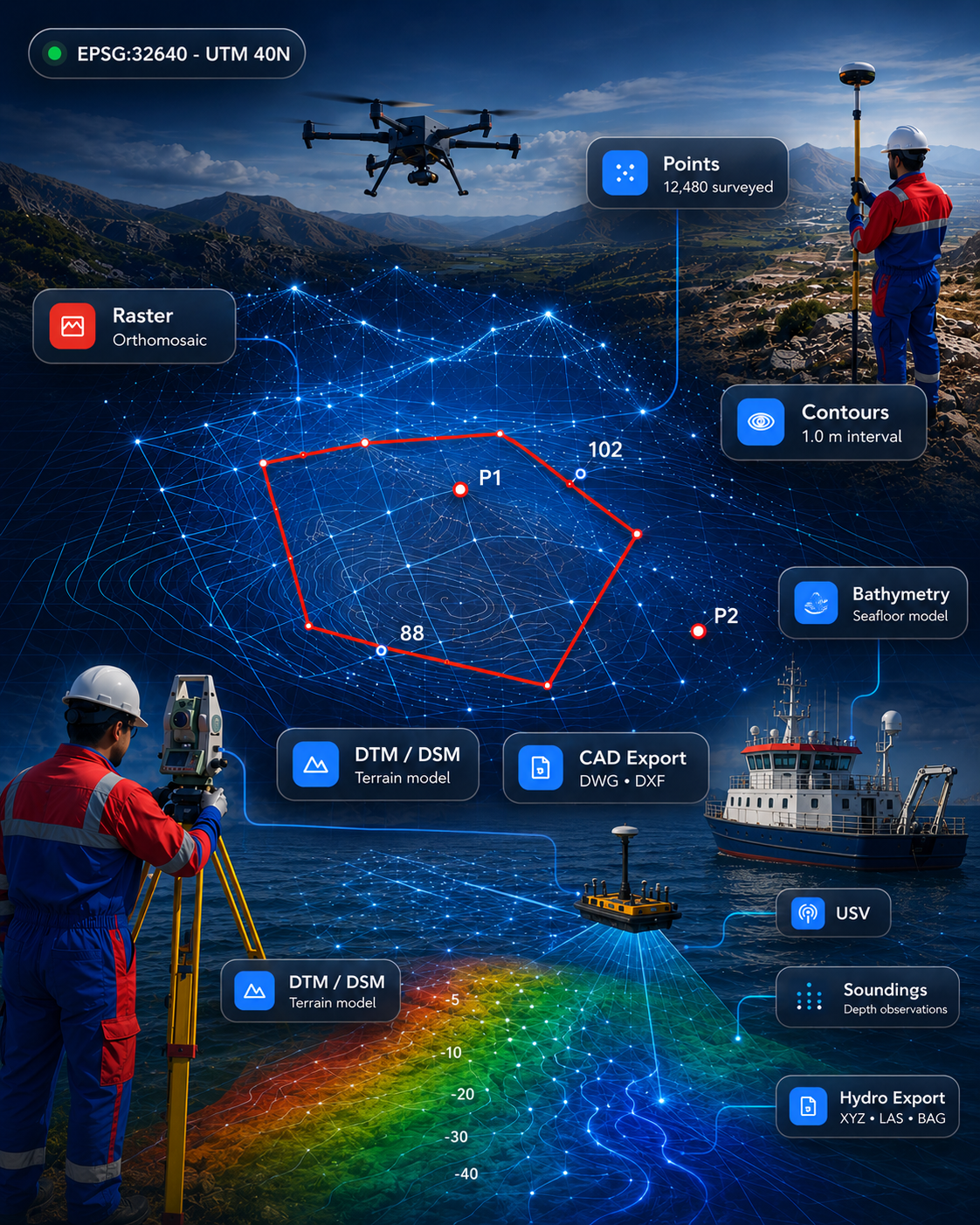
GISMappers SurveyCAD Pro related field image Related survey image used for this product page.
Product details

Related image, scope and fit

SurveyCADGISPoint Cloud

What it does

Deliver a field-to-finish workflow from survey data through drafting, terrain modelling and final deliverable production.

How it helps

Combine CAD drafting, GIS data handling, point cloud support and topographic output workflows in one platform.

Where it fits

Help survey teams produce dependable drawings, models and structured geospatial outputs more efficiently.

Key capabilities

  • Combines drafting, surfaces, GIS and survey production
  • Supports topographic workflows, point clouds and terrain modelling
  • Built for professional CAD, GIS and survey deliverables
Capabilities & outputs

Operational value

Core capabilities

  • Combines drafting, surfaces, GIS and survey production
  • Supports topographic workflows, point clouds and terrain modelling
  • Built for professional CAD, GIS and survey deliverables

Typical outputs

  • Survey drawings and CAD layouts
  • Terrain models, contours and sections
  • GIS outputs and final deliverables
Product page ready
Back to Software Catalogue
Best suited for

Workflows and sectors

This product is relevant to the following workflow areas and project contexts.

Topographic Survey<\/span>CAD Production<\/span>GIS Management<\/span>Deliverable Workflow<\/span>
FAQ

Questions, answered

What is SurveyCAD Pro best known for?
It is positioned as the all-in-one survey drafting and geospatial workflow platform across topographic survey, CAD, GIS and point-cloud related production.
Who should consider it?
Survey companies, engineering teams and mapping professionals needing one platform for dependable field-to-finish deliverables.
Let's build it together

Ready to discuss GISMappers SurveyCAD Pro?

Talk to our team about demonstrations, deployment options and how this product fits your survey or engineering workflow.