GIS Mapping
Custom GIS Dashboards & Web Applications Saudi Arabia | GISMappers

Intelligent Geospatial Dashboards for Smarter Decisions

GISMappers offers advanced GIS mapping and geospatial solutions through custom-built dashboards and web-based GIS platforms. Our expert developers integrate AI-powered GIS analytics, predictive GIS modeling, and IoT GIS solutions to deliver real-time, data-driven insights for your operational needs.

From topographic surveys and drone surveys to underground utility detection and environmental monitoring, our dynamic web GIS applications support diverse industry requirements — all powered by cloud-based infrastructure and modern spatial technologies.

GIS Dashboard Interface
Web GIS Application

Key Capabilities:

1. Real-Time GIS Dashboards
  • Smart city planning tools and KPI-based heatmaps
  • Live data feeds from IoT, GPS, and remote sensors
  • Spatial analytics and AI-driven visualizations
2. Web GIS Applications
  • Interactive interfaces with routing, search, and layer control
  • Responsive and cloud-hosted for desktops, tablets, and mobiles
  • Seamless integration with PostGIS, MySQL, and GeoServer
3. Advanced Technology Stack
  • Leaflet, Mapbox, OpenLayers, ArcGIS JS API, React, Vue
  • Backend with Node.js, PHP, Python (Flask/Django)
  • Spatial databases using PostgreSQL/PostGIS and MySQL
4. Industry-Ready Applications
  • Land surveying, terrain analysis, and LiDAR surveys
  • Infrastructure asset mapping & highway engineering
  • Environmental monitoring and BIM modeling integration
5. Secure & Scalable Deployments
  • Cloud-based GIS and SaaS models (AWS, Azure)
  • Role-based user access, encryption, and token-auth APIs

Industries We Serve:

  • Smart cities & urban planning
  • Environmental & disaster risk management
  • Energy, utilities & infrastructure
  • Agriculture, forestry, and land use

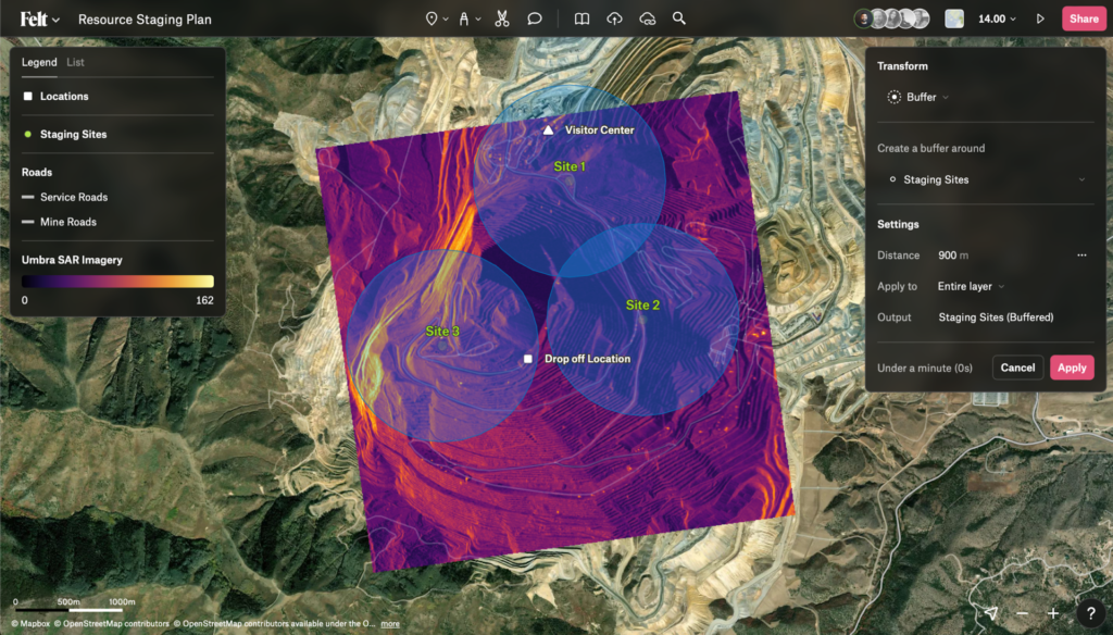
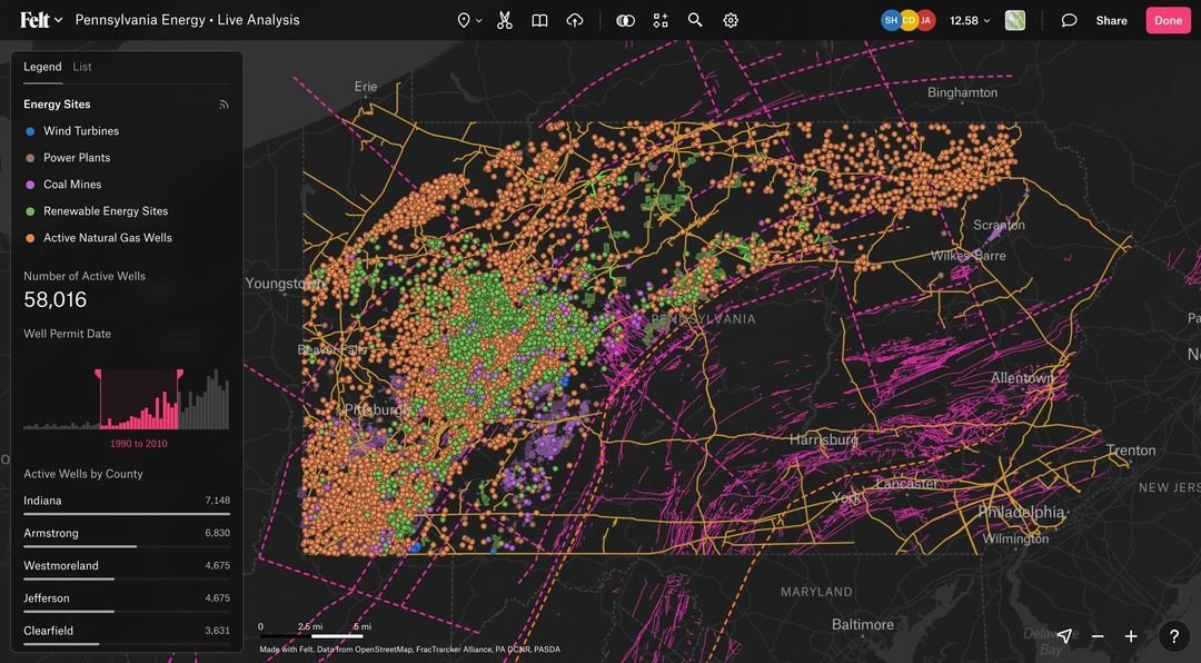
Empower your operations with a customized GIS SaaS dashboard or web mapping application designed for spatial precision and AI geospatial analytics. Partner with GISMappers to transform your geospatial data into real-world insights.