GIS Mapping
Pipeline & Overhead Line (OHL) Surveys in Saudi Arabia | GIS Mappers

Pipeline & Overhead Line (OHL) Surveys in Saudi Arabia

At GIS Mappers, we offer specialized pipeline surveys and overhead line (OHL) surveys in Saudi Arabia to support utility corridor development, infrastructure design, and transmission planning. Our services ensure precise route alignment, environmental compliance, and topographic profiling using cutting-edge tools such as UAVs, LiDAR, GPS RTK, and GIS platforms.
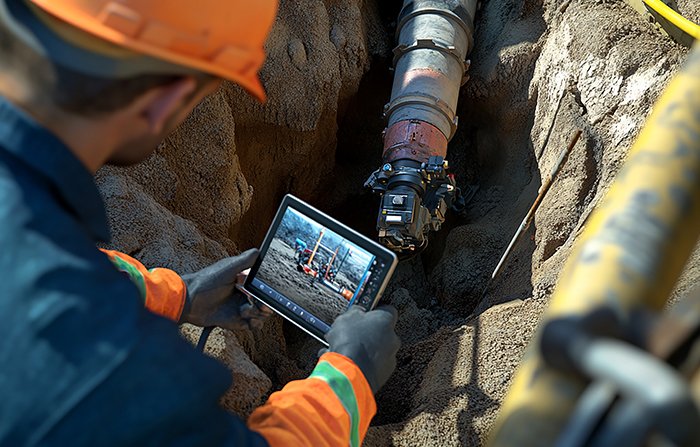
Pipeline Survey in Saudi Arabia
Overhead Line Survey Saudi Arabia

Key Features & Benefits:

1. Route Alignment & Utility Corridor Mapping
  • Optimized route selection for pipelines and powerlines using UAVs, total stations, and GPS RTK systems.
  • Identifies terrain features, obstacles, and regulatory constraints in Saudi Arabia’s varied landscapes.
2. Topographic Profiling & Longitudinal Sections
  • Elevation profiles and slope analysis for trench depth, bending radii, and OHL tower positions.
  • Vital for water, gas, oil, and fiber optic pipeline infrastructure in Saudi Arabia.
3. OHL Tower Positioning & Clearance Surveys
  • Accurate tower spacing, sag calculation, and OHL clearance analysis over roads, buildings, and terrain.
  • Meets transmission safety standards and national grid regulations.
4. LiDAR Mapping & UAV Survey Integration
  • Rapid 3D terrain data collection in desert or remote Saudi regions.
  • Produces high-resolution 3D point clouds and orthomosaics for design visualization.
5. GIS Mapping & AutoCAD Civil 3D Output
  • Data delivered in formats compatible with GIS platforms, Civil 3D, and BIM models.
  • Ideal for digital twin integration and asset lifecycle management.
6. Utility Conflict Detection & ROW Permitting
  • Identifies underground and overhead utility conflicts before project execution.
  • Supports permitting, documentation, and right-of-way (ROW) approval processes in KSA.

From cross-country pipeline surveys to transmission line surveys in Saudi Arabia, GIS Mappers ensures reliable geospatial intelligence tailored for engineering, construction, and utility projects. Our end-to-end survey solutions contribute to safe, efficient, and regulation-compliant infrastructure development across the Kingdom.

Contact us to learn how our topographic surveys, LiDAR mapping, and GIS mapping services can enhance your project execution in Saudi Arabia.