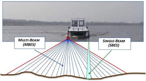
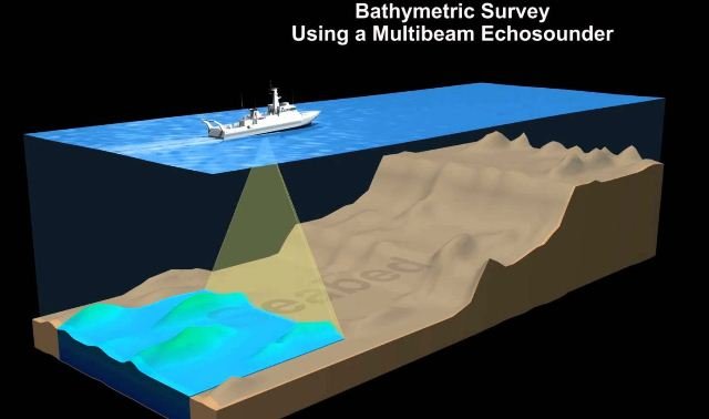
A Multibeam Bathymetry Survey is an advanced hydrographic mapping technique that uses multiple acoustic beams to capture highly detailed and accurate 3D representations of the seafloor. Unlike Single Beam Bathymetry, which measures depth at a single point per pulse, Multibeam Echo Sounders (MBES) emit multiple beams simultaneously across a wide swath, covering large areas of the seabed with high precision.
These surveys are critical for marine engineering, underwater infrastructure planning, navigation safety, environmental studies, and offshore energy projects. GISMappers specializes in conducting multibeam surveys using state-of-the-art equipment, ensuring accurate seabed characterization for a wide range of industries.
At GISMappers, we utilize advanced Multibeam Echo Sounder (MBES) systems integrated with RTK GNSS positioning and motion sensors to ensure unparalleled accuracy in seabed mapping. Our surveys support government agencies, energy companies, environmental researchers, and marine industries in making informed decisions for their projects.
© Copyright 2025. All Rights Reserved by GISMappers Saudi Arabia