GIS Mapping
"Bathymetric, Marine & Land Survey Services Saudi Arabia | GISMappers"
Geospatial Solutions

1025+

Completed Work

GIS ABOUT US

Precision Bathymetric &
Topographic Surveys

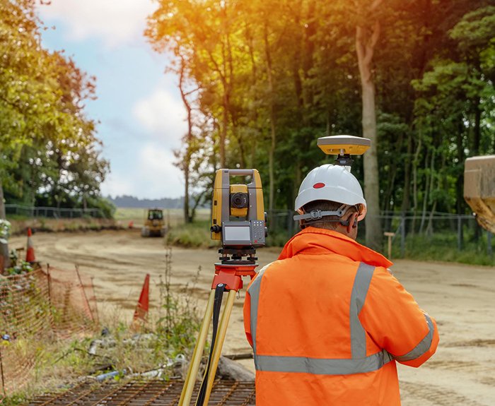
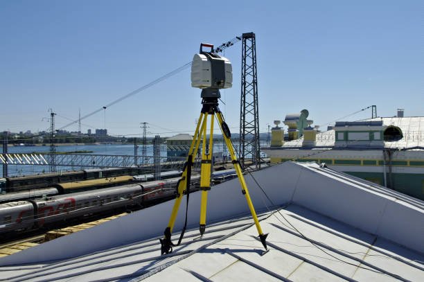
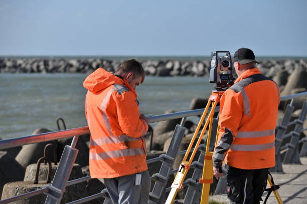
At GISMappers, in partnership with Nusail Survey, we provide expert bathymetric surveys, hydrographic surveys, seabed mapping, and marine pipeline inspection surveys across Saudi Arabia, including Dammam, Khobar, Riyadh, and Jeddah. Using advanced multibeam sonar, LiDAR, and drone technology, we support marine infrastructure, port construction, and coastal development projects with precise geospatial data.

Our services also include topographic and land surveys, geophysical surveys, and environmental baseline studies. Leveraging cloud-hosted GIS platforms and remote sensing tools, we deliver accurate results for single-beam and multibeam surveys, sub-bottom profiler surveys, and oceanographic studies, ensuring reliable insights for safe and efficient project execution.

drone-based surveys OUR SERVICES

Our Provided Services

Marine Survey - Chemical Oceanography - Metocean Services

Marine Survey - Chemical Oceanography - Metocean Services

We provide Marine and Hydrographic Surveys, including Seabed Mapping and Oceanographic Studies in Saudi Arabia.

Read More

Topographic Surveys

Topographic Surveys

Precise Topographic and Land Surveys for construction, infrastructure, and site development across Saudi Arabia.

Read More

3D Laser Scanning Surveys

3D Laser Scanning Surveys

Advanced 3D Laser Scanning and Geospatial Data Capture for engineering and infrastructure projects in Saudi Arabia.

Read More

Drone & Remote Sensing

Drone & Remote Sensing Surveys

Drone-based Surveys and Remote Sensing solutions for environmental monitoring, coastal, and land mapping in Saudi Arabia.

Read More

AI & Big Data GIS
Analytics

AI & Big Data GIS Analytics

AI-powered GIS Analytics for Geophysical, Environmental Baseline Studies, and Marine Survey data analysis.

Read More

Cloud-Based GIS & AI Solutions

Cloud-Based GIS & AI Solutions

Cloud-hosted GIS and AI solutions for Bathymetric, Topographic, and Geospatial Survey data management.

Read More

Utility & Infrastructure Mapping

Utility & Infrastructure Mapping

Comprehensive Utility, Pipeline Inspection, and Infrastructure Mapping surveys across Saudi Arabia.

Read More

Custom GIS Software & API Development

Custom GIS Software & API Development

Custom GIS software and API development tailored for Bathymetric and Hydrographic Survey projects.

Read More

Highway Engineering

Highway Engineering

Surveying and Mapping services for Highway Engineering and Road Infrastructure development in Saudi Arabia.

Read More

OUR JOURNEY

Leading Bathymetric, Marine & Land Survey
Solutions Since 2025

GISMappers

99%

SATISFAID CLIENTS

GISMappers

15+

COUNTRIES WORLDWIDE

GISMappers

98%

BUSINESS GROWTH

GISMappers

50+

EXPERT STAFFS

Marine, Bathymetric, Topographic Survey Saudi Arabia OUR TECHNOLOGY STACK

Advanced Tools for Bathymetric, Marine &
Topographic Surveys

Bathymetric Survey Technology Saudi Arabia
Bathymetric, Marine & Topographic Survey Projects Saudi Arabia OUR PROJECT PORTFOLIO

Showcasing Our Bathymetric, Marine & Topographic
Survey Works Across Saudi Arabia

Saudi Arabia Marine & Land Survey Solutions WHY CHOOSE US

Trusted Bathymetric, Marine & Land Survey Experts in Saudi Arabia

Bathymetric Survey & Topographic Mapping Saudi Arabia
Specialized Bathymetric & Hydrographic Surveys in Saudi Arabia
Custom GIS Software & API Development OUR EXPERT TEAM

Meet Our Expert Team

Manjini Anandaraj
Manjini Anandaraj
Managing Director / GIS Analyst / Remote Sensing Specialist / Highway Design Engineer / Marine & Geomatics Surveyor
Marie Therese Sangy
Marie Therese Sangy
Chief Operations Officer / Business Development Manager / Organizational Psychologist
Yuvanica
Yuvanica
Aspiring Geographer / Environmental Enthusiast
Marine & Land Survey Services Saudi Arabia OUR WORK PROCESS

How We Deliver Accurate Survey Solutions

GISMappers operates through a specialized marine, land, and geospatial surveying model, offering tailored services
such as bathymetric surveys, hydrographic surveys, and seabed mapping throughout Dammam, Khobar, Riyadh, and Jeddah.

Bathymetric & Hydrographic Surveys
01
Marine & Bathymetric Survey Projects

Precise seabed mapping, sub-bottom profiling, and multibeam sonar solutions in Saudi Arabia

Topographic & Land Surveys
02
Topographic & Land Survey Services

Civil and infrastructure surveys using drones, LiDAR, and cloud-hosted GIS platforms

Geophysical & Environmental Baseline Surveys
03
Geophysical & Environmental Surveys

Sub-bottom profiling, oceanographic studies, and environmental baseline assessments

GIS AI & Cloud Training Saudi Arabia
04
GIS, AI & Cloud Training Programs

Workshops on GIS software, AWS cloud solutions, and AI-powered geospatial analytics

Marine Survey Saudi Arabia
Contact Us

Looking for expert marine survey, hydrographic survey, or topographic survey services in Saudi Arabia? Partner with GISMappers, specialists in geospatial AI solutions, cloud-hosted GIS platforms, and drone mapping technologies. We deliver precise data for coastal development, marine infrastructure, and environmental monitoring projects.

Get in Touch

Contact us today for marine surveys, topographic mapping, geophysical studies, and cloud GIS services across Saudi Arabia. Our expert team is ready to support your next project!

trusted By Over 1500 Of the Worlds Leading Companies

Marine Survey - Chemical Oceanography - Metocean Services
Topographic Surveys
3D Laser Scanning Surveys
Drone & Remote Sensing Surveys
AI & Big Data GIS Analytics
Cloud-Based GIS & AI Solutions